GTA 6 Locations Spotted: Every Named District, County and Region
Every named or identifiable location across GTA 6 Trailer 1 and Trailer 2, from Vice City neighborhoods to Port Gellhorn, Mount Kalaga, Leonida Keys and beyond.
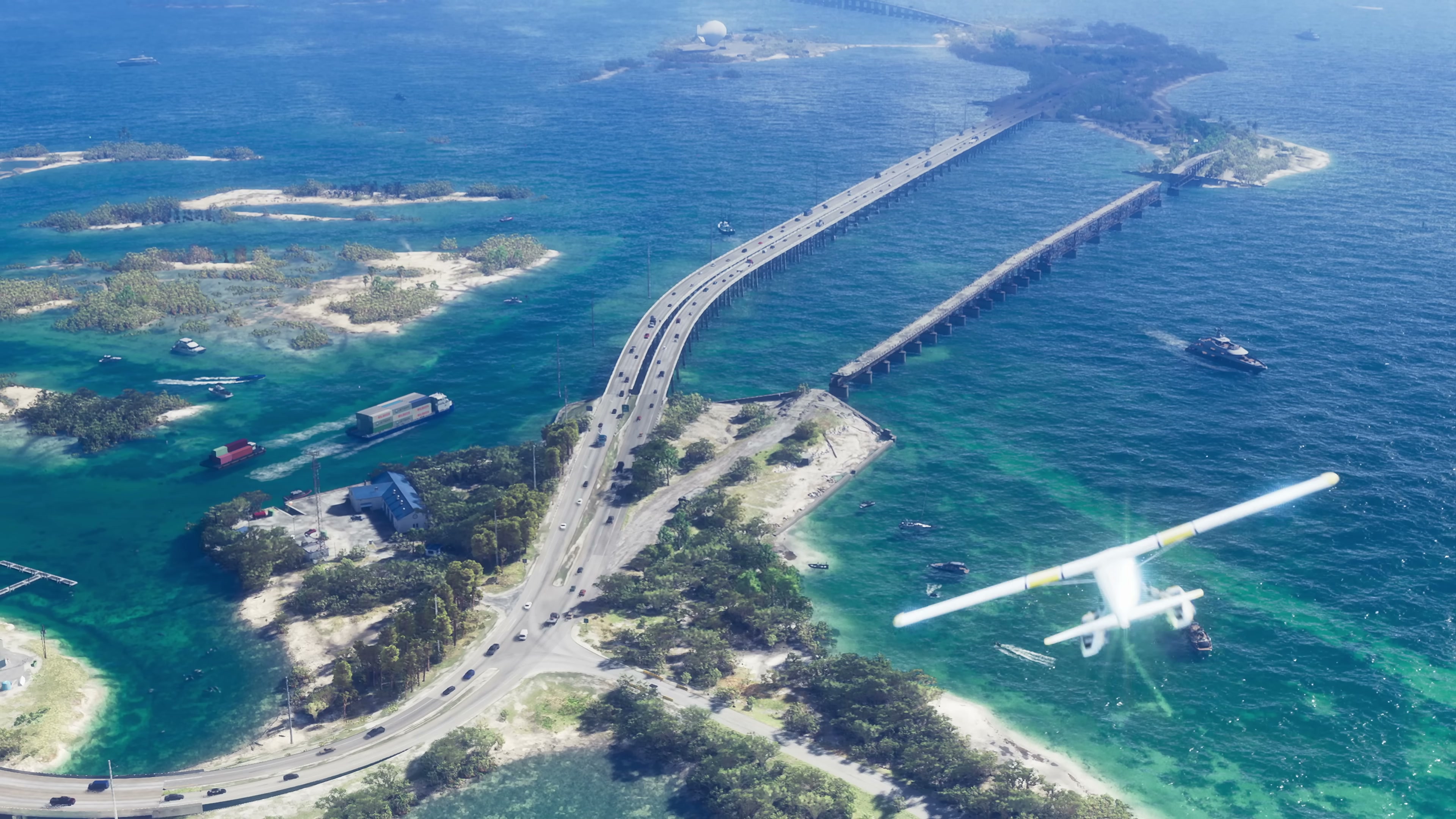
Trailer 1, 0:35 — the Leonida Keys causeway, the south-bound spine of the new map.
Grand Theft Auto VI Trailer 1 · timestamp 0:35 · © Rockstar Games / Take-Two Interactive · Reproduced for editorial commentary under fair use. Retrieved May 21, 2026.
This breakdown maps every named or visually identifiable location across both Grand Theft Auto VI trailers — the December 2023 reveal (Trailer 1) and the May 2025 follow-up (Trailer 2). The scope is deliberately conservative: only places named on-screen, named in Rockstar’s published copy, or made unambiguous by overhead signage are treated as confirmed. Community map-builders have inferred far more, and we surface their best-supported additions in a separate section so the line between “shown” and “triangulated” stays clean.
The state of Leonida, at a glance
Rockstar’s stated setting is Leonida, a fictional U.S. state modelled after Florida, with Vice City as its dominant urban centre. Trailer 1 spent most of its 90 seconds inside Vice City; Trailer 2 used its longer 2:47 runtime to push outward — through the Keys, the swamp interior, and a string of newly named counties and towns to the north.
Jetro’s “100+ Hidden Details” video paraphrases the marketing copy at 0:26 as describing a setting that “stretches across the state of Leonida,” which matches Rockstar’s own framing on the official VI page. That outward-facing posture is why this article is organised by region, not by trailer.
| Region | Status | First on-screen | Real-world analogue |
|---|---|---|---|
| Vice City (metro) | Named on signage and in marketing | Trailer 1, 0:00 | Miami |
| Leonida Keys | Named in Rockstar copy + signage | Trailer 1, 0:35 | Florida Keys |
| Port Gellhorn | Named in Trailer 2 marketing & signage | Trailer 2 | Florida Panhandle port towns |
| Mount Kalaga | Named in Trailer 2 marketing | Trailer 2 | Florida high points / state parks |
| Ambrosia | Named in Trailer 2 marketing | Trailer 2 | Small inland town archetype |
| Grassrivers | Named in Trailer 2 marketing | Trailer 2 | Everglades / Big Cypress |
| Leonida (state) | Named by Rockstar from reveal | Trailer 1, 0:00 | Florida |
Vice City: districts and corridors named on-screen
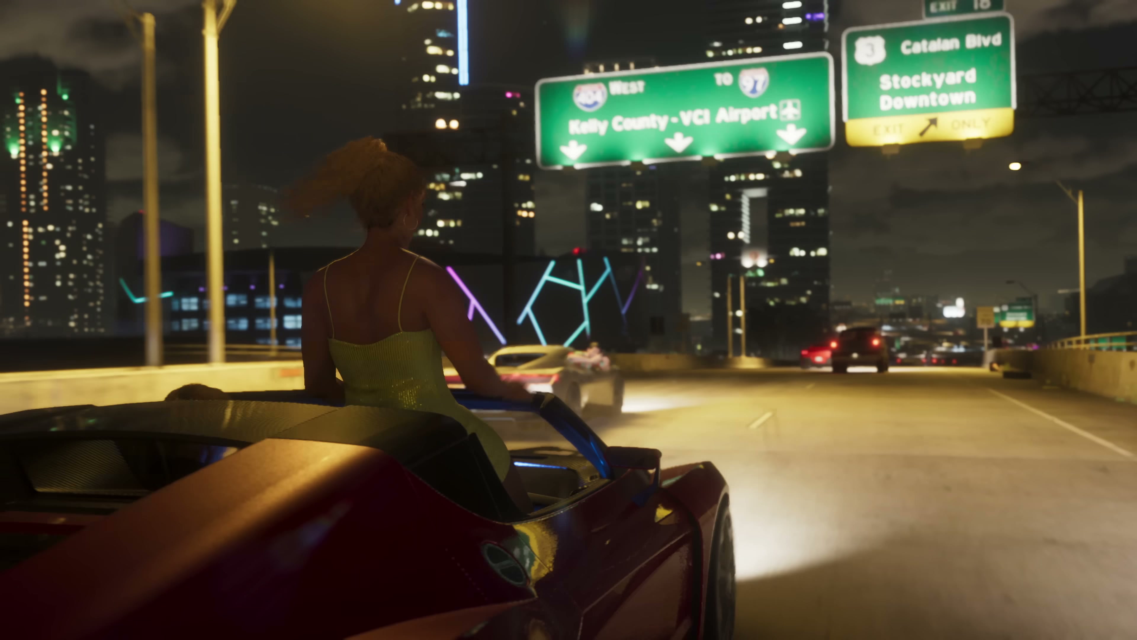
Vice City is the only location for which both trailers give us internal district names rather than just the city label. The most legible source is the overhead highway signage in Trailer 1 at 0:24 (Lucia in the red convertible), which spells out a multi-district hierarchy in a single shot.
| District / sub-area | Source | What it is |
|---|---|---|
| Downtown | Trailer 1 highway sign, 0:24 | Vice City’s high-rise core |
| Stockyard | Trailer 1 highway sign, 0:24 | Industrial / working district |
| Catalan Blvd | Trailer 1 highway sign, 0:24 | Named arterial road |
| Kelly County | Trailer 1 highway sign, 0:24 | County containing Vice City suburbs |
| VCI Airport (Vice City International) | Trailer 1 highway sign, 0:24; sign visible in Trailer 2 | The metro airport |
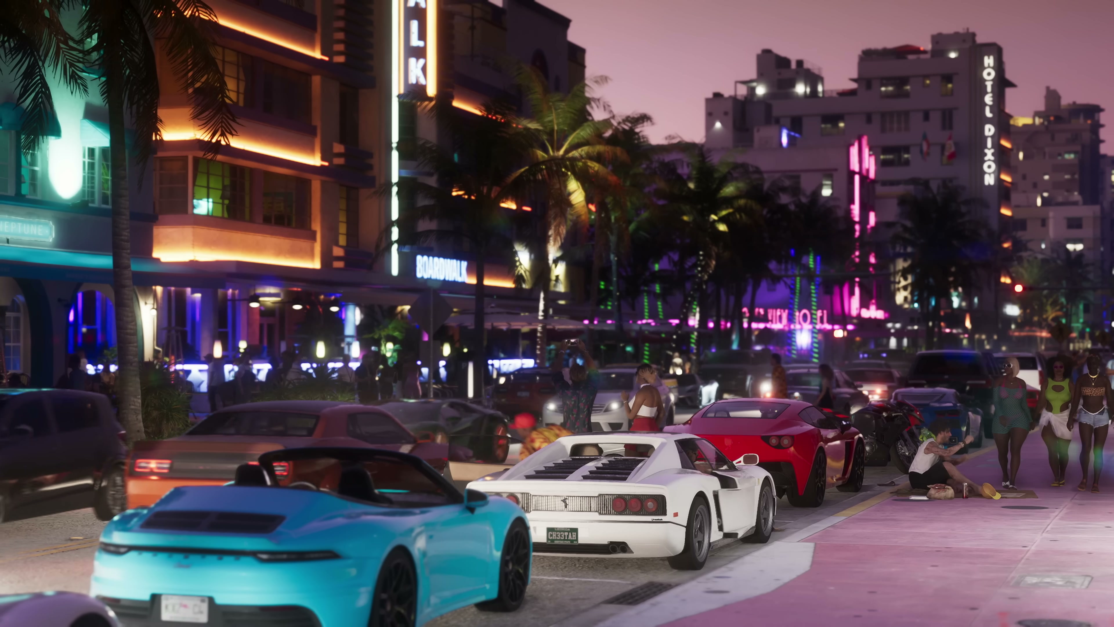
| Ocean Beach | Trailer 1, 0:32 nightlife strip; named in Trailer 2 marketing | Art Deco hotel / beach strip — South Beach analogue |
| Vice City Boulevard | Trailer 1, 0:32; Trailer 2, identified by community at ~11:17 | Main nightlife corridor (per Jetro’s identification of the matching street geometry) |
| Vice Beach | Marketing copy + multiple beach shots | Wider beach district encompassing Ocean Beach |
IGN’s “89 Details” video at 7:57 specifically points at signage for the Ocean View Hotel, “its neighboring Ocean Beach, and the sign outside of Vice City Airport,” all in Trailer 2. The Ocean View / Ocean Beach pairing matches the Miami Beach Art Deco district very closely, and the hotel name itself is a callback to the original 1986-set Vice City (where “Ocean View Hotel” was Tommy Vercetti’s first safehouse).
The night-time strip in Trailer 1 at 0:32 — with “Hotel Dixon” and “Boardwalk” neon, palm trees and sports cars at the kerb — is the same district viewed from street level. Trailer 2 returns to it twice: once at 1:39 with the “NINE” outdoor club marked explicitly “Vice City,” and again in the chase sequence that Jetro pegs to Vice City Boulevard at 11:17.
The freestanding “VICE” letters in Trailer 1 at 0:39 are not a district name but a hilltop landmark sign; community map-builders catalogued by Dandy Andy (around 2:25 in the “80% Accurate” video) have placed it on a ridge overlooking the bay, similar to how the Hollywood sign anchors a real-world skyline.
The Leonida Keys
The southern archipelago is the second-most-cited region across both trailers. Trailer 1’s aerial at 0:35 establishes the geometry — long causeways linking small islands across turquoise shallows — and Trailer 2 anchors a substantial chunk of its narrative there.
Jetro at 0:45 identifies “the Leonida Keys, which is a real life hot spot for drug trafficking,” and IGN at 1:38 specifies that Cal Hampton “is a longtime drug runner, smuggling product through the Leonida Keys” via his boat business with the Leonida Marine Center (the latter named on his t-shirt per IGN at 0:58). The Keys are therefore both a setting and a story device.
| Keys element | Trailer | Notes |
|---|---|---|
| Long causeway over shallow water | T1 0:35 (aerial), T1 0:02 (sunset) | Visual analogue to U.S. Route 1 / Overseas Highway |
| Seaplane traffic | T1 0:35 | Implies an air-tour or smuggling economy |
| Leonida Marine Center | T2 0:58 (t-shirt) | Named business tied to the Keys per IGN |
| Cal Hampton’s boat operation | T2 1:38–1:40 | Story-anchored Keys content |
| Drug-runner subtext | T2 across multiple scenes | Real-world Keys analogue |
Dandy Andy’s video at 6:03 cites a community measurement that “the distance from the Southern Keys to Northern Vice City measures approximately 14.54 km or 9.03 mi” — that figure is fan-derived from leaked map data, not from Rockstar, and we flag it as such in the open-questions section below.
Northern Leonida: Port Gellhorn, Mount Kalaga, Ambrosia, Grassrivers
Trailer 2’s marketing copy introduced four region names that Trailer 1 had not used. Dandy Andy summarises the list at 4:25 as: “Ambrosia, Watson Bay, Port Gellhorn, and Mount Kalaga.” Combined with the official Rockstar VI page copy, the confirmed northern set is:
| Location | Type | What we publicly see | Source |
|---|---|---|---|
| Port Gellhorn | Port town | Industrial waterfront, working-class streets, named in marketing | Rockstar VI page; community at Dandy Andy 4:25 |
| Mount Kalaga | Elevated / National Park area | Forest, ridge lines, hiking imagery | Rockstar VI page; community at Dandy Andy 4:25 |
| Ambrosia | Small town | Strip-mall and roadside Americana shots in T2 | Rockstar VI page; community at Dandy Andy 4:25 |
| Grassrivers | Swamp / wetlands | Airboats, marsh interiors in T2 | Rockstar VI page; T2 swamp imagery |
| Watson Bay | Coastal bay | Community-identified in T2 | Dandy Andy 4:25 |
| Peacock Bay | Coastal | Called out as a “new named location” by Jetro at 4:06 | Jetro 4:03–4:08 |
| Vice Dale County | County | Listed by Jetro at 14:37 among “new named locations” | Jetro 14:37 |
| Draper Island | Island | Listed by Jetro at 14:37 | Jetro 14:37 |
| Leonida Department of Corrections | Institution (state-wide) | Lucia’s orange jumpsuit, per IGN at 3:28 | IGN 3:30 |
Mount Kalaga and Grassrivers together do something the GTA V map already did for San Andreas — they bracket the urban core with a national-park-style highland and a wetland interior. The implication, supported by IGN at 14:32 noting “a fast travel system between the game’s major locations,” is that the map is large enough for region-to-region travel to be a meaningful design problem.
Specific named buildings, venues and signs
Beyond districts, the trailers name specific places. These are useful because they will likely become explorable interiors, mission locations, or branded businesses.
| Name | Trailer / timestamp | Type | Notes |
|---|---|---|---|
| Hotel Dixon | T1 0:32 | Art Deco hotel | Vice City Boulevard / Ocean Beach strip |
| Boardwalk (signage) | T1 0:32 | District / venue marker | Same strip |
| Ocean View Hotel | T2 (IGN 7:57) | Hotel | Callback to Vice City (2002) |
| Vice City Airport / VCI | T1 0:24; T2 (IGN 7:59) | Airport | Named in two trailers |
| NINE | T2 1:39 | Outdoor nightclub | ”Vice City” sub-label on signboard |
| Leonida Marine Center | T2 0:58 (IGN) | Marina / business | Cal Hampton t-shirt |
| Leonida Department of Corrections | T2 3:28–3:30 (IGN) | State institution | Lucia’s jumpsuit |
| VICE letter sign | T1 0:39 | Landmark | Hilltop installation |
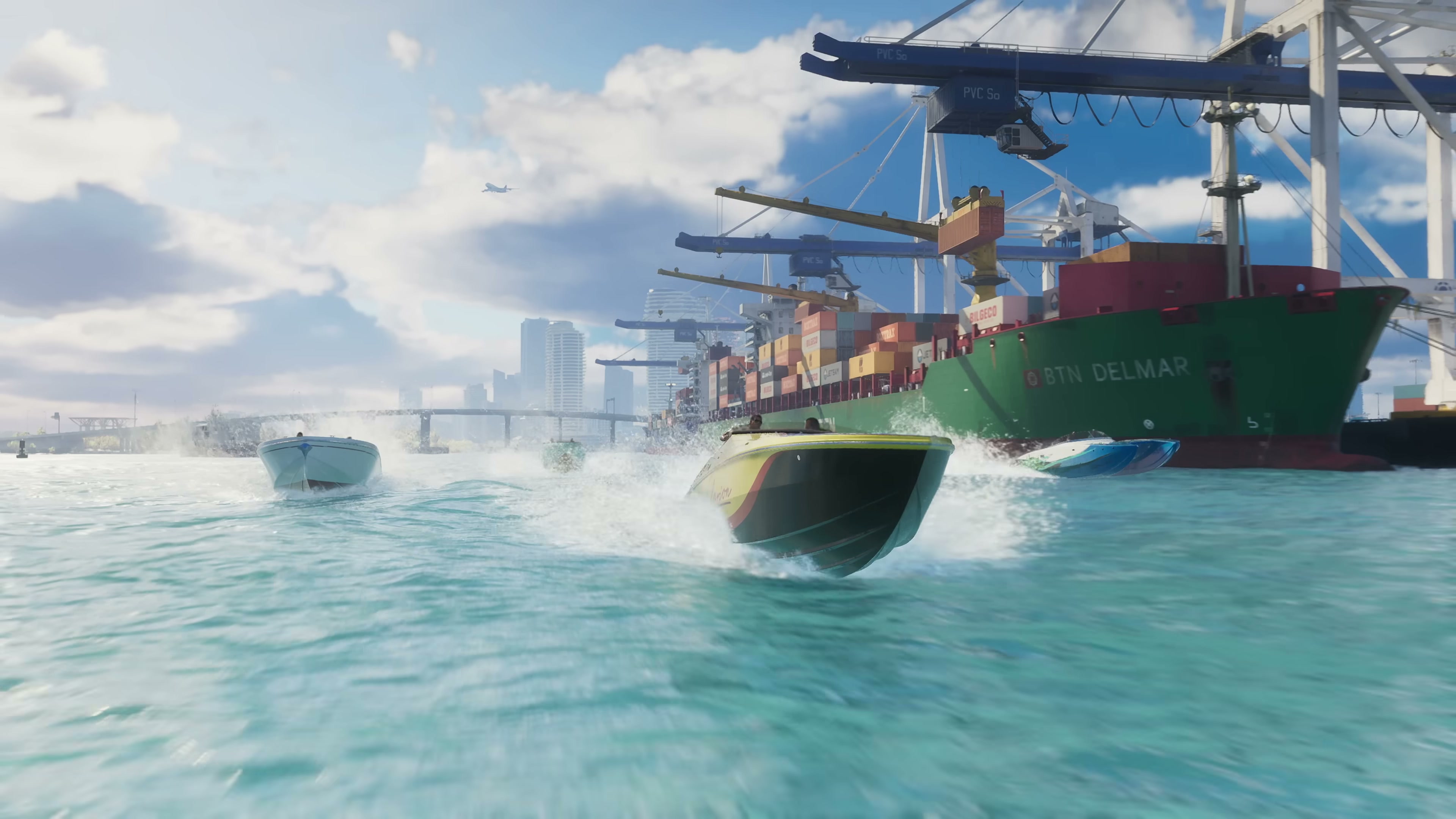
| BTN DELMAR (container ship) | T1 0:23 | Vessel + port | Working-port signage |
Cross-trailer comparison: same place, two looks
Several locations appear in both trailers, which is useful for confirming geography rather than just isolated set pieces.
| Location | Trailer 1 appearance | Trailer 2 appearance | What the comparison tells us |
|---|---|---|---|
| Vice City skyline | 0:21 beach, 0:32 strip, 0:37 rooftop pool | 1:39 nightclub, 2:20 jet ski with skyline | Same skyline silhouette from beach, rooftop and bay angles |
| Leonida Keys | 0:35 aerial causeway | 1:38–1:40 Cal Hampton boat scenes | Establishing shot in T1, story role in T2 |
| Vice City Boulevard / Ocean Beach | 0:32 night strip | T2 chase identified by Jetro at 11:17 | Same neon corridor revisited |
| Causeway over water | 0:02 sunset aerial, 0:35 daytime aerial | 2:20 bay shot reuses same waterway | Reinforces single-state geography |
| VCI Airport | 0:24 highway sign | Sign visible per IGN 7:59 | Named twice, confirming a real interior likely exists |
Real-world analogues, region by region
Dandy Andy at 3:17 summarises the community workflow: “use Google Earth data to match Grand Theft Auto 6 locations with their real Florida counterparts.” The mapping below is editorial — drawn from visible terrain features, not Rockstar statements — and is presented as “appears to correspond to,” not “is.”
| GTA 6 region | Most likely real-world basis | Visual cues used |
|---|---|---|
| Vice City | Miami (esp. Miami Beach, Downtown, Brickell, MIA airport) | Art Deco strip, port cranes, causeway geometry, skyline density |
| Ocean Beach | South Beach / Ocean Drive | Pastel Art Deco frontage in T1 0:32 |
| Leonida Keys | Florida Keys / Overseas Highway | Causeway shape in T1 0:35 |
| Port Gellhorn | Florida Panhandle port towns (Pensacola, Panama City) | Marketing imagery, name structure |
| Mount Kalaga | Florida state parks / Torreya / Britton Hill area | ”Mount” naming is itself a Florida joke |
| Grassrivers | Everglades / Big Cypress | Sawgrass, airboats in T2 |
| Ambrosia | Generic central-Florida small town | Strip-mall framing |
| Kelly County | Suburban county outside Miami (Broward / Miami-Dade analogue) | Named on T1 highway sign |
Still unverified / open questions
The list of named places is now broad, but several geographical questions are still not answered by publicly released material.
- Exact map size. The 14.54 km Keys-to-north figure quoted by Dandy Andy at 6:03 is fan-derived from leak data, not from Rockstar. Treat it as an upper-bound community estimate, not a published spec.
- Which northern names are towns vs. counties vs. regions. Rockstar’s copy lists names without consistently labelling administrative type. Whether Ambrosia is a town inside a county, or a region, is not stated.
- Interior playability. Named buildings (Ocean View Hotel, Leonida Marine Center, NINE nightclub) appear in trailers, but trailers do not confirm whether their interiors are explorable.
- Fast travel mechanics. IGN at 14:32 notes that some scenes hint at “a fast travel system between the game’s major locations,” but Rockstar has not confirmed how fast travel works or whether it is gated.
- Whether Georgia is in-bounds. Jetro at 4:03 says “Georgia has also been added to the game.” This is community inference from a sign, not a Rockstar statement, and the in-game state border has not been confirmed.
- Mount Kalaga playable elevation range. The community treats it as a national-park-style area, but elevation, snowline, and whether it supports off-road gameplay are not yet shown.
- Draper Island, Vice Dale County, Peacock Bay, Watson Bay. These names come from on-screen signage spotted by creators but have not (yet) been individually highlighted by Rockstar’s own marketing.
- Where Jason and Lucia’s safehouse sits. Jetro at 12:08 identifies a candidate location, but the trailers do not name the district.
Related reading
- Trailer 1 overview — the original Vice City reveal in context
- Trailer 2 overview — Leonida tour and expanded cast
- Vice City entity page
- Leonida Keys entity page
- Mount Kalaga entity page
- Port Gellhorn entity page
- Ambrosia entity page
- Grassrivers entity page
This page will be updated whenever Rockstar adds new official material or community map-builders converge on new confirmed location names. The last revision date in the frontmatter reflects the most recent pass.
Gallery
Trailer 1, 0:23 — Vice City's working waterfront, distinct from the Ocean Beach tourist strip.
Grand Theft Auto VI Trailer 1 · timestamp 0:23 · © Rockstar Games / Take-Two Interactive · Reproduced for editorial commentary under fair use. Retrieved May 21, 2026.
Trailer 1, 0:24 — overhead signage names four sub-areas: Kelly County, VCI Airport, Catalan Blvd, Stockyard and Downtown.
Grand Theft Auto VI Trailer 1 · timestamp 0:24 · © Rockstar Games / Take-Two Interactive · Reproduced for editorial commentary under fair use. Retrieved May 21, 2026.
Trailer 1, 0:32 — the Ocean Beach / Vice City Boulevard nightlife corridor.
Grand Theft Auto VI Trailer 1 · timestamp 0:32 · © Rockstar Games / Take-Two Interactive · Reproduced for editorial commentary under fair use. Retrieved May 21, 2026.
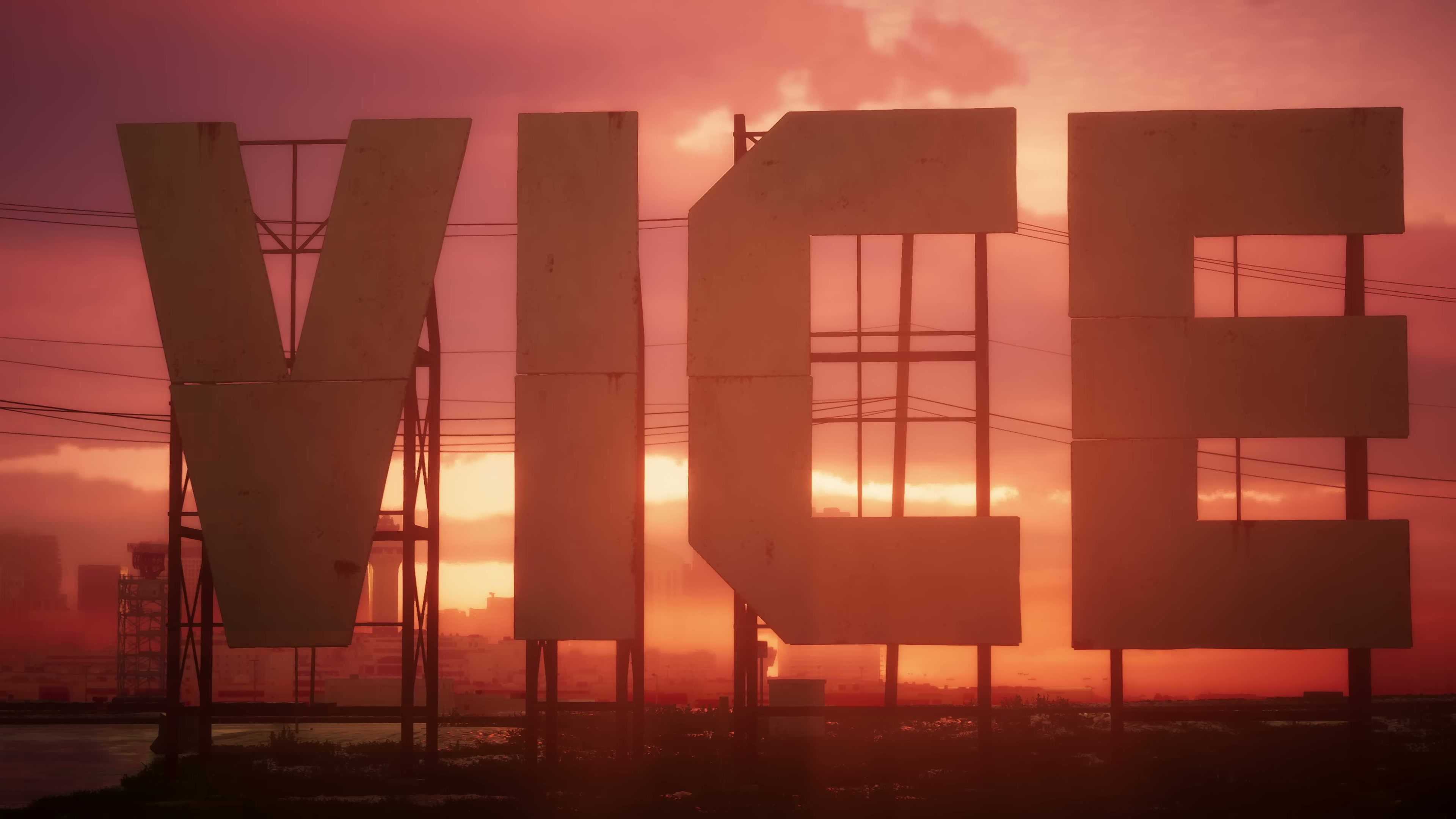
Trailer 1, 0:39 — the freestanding VICE sign, since identified as a hilltop landmark by community map-builders.
Grand Theft Auto VI Trailer 1 · timestamp 0:39 · © Rockstar Games / Take-Two Interactive · Reproduced for editorial commentary under fair use. Retrieved May 21, 2026.
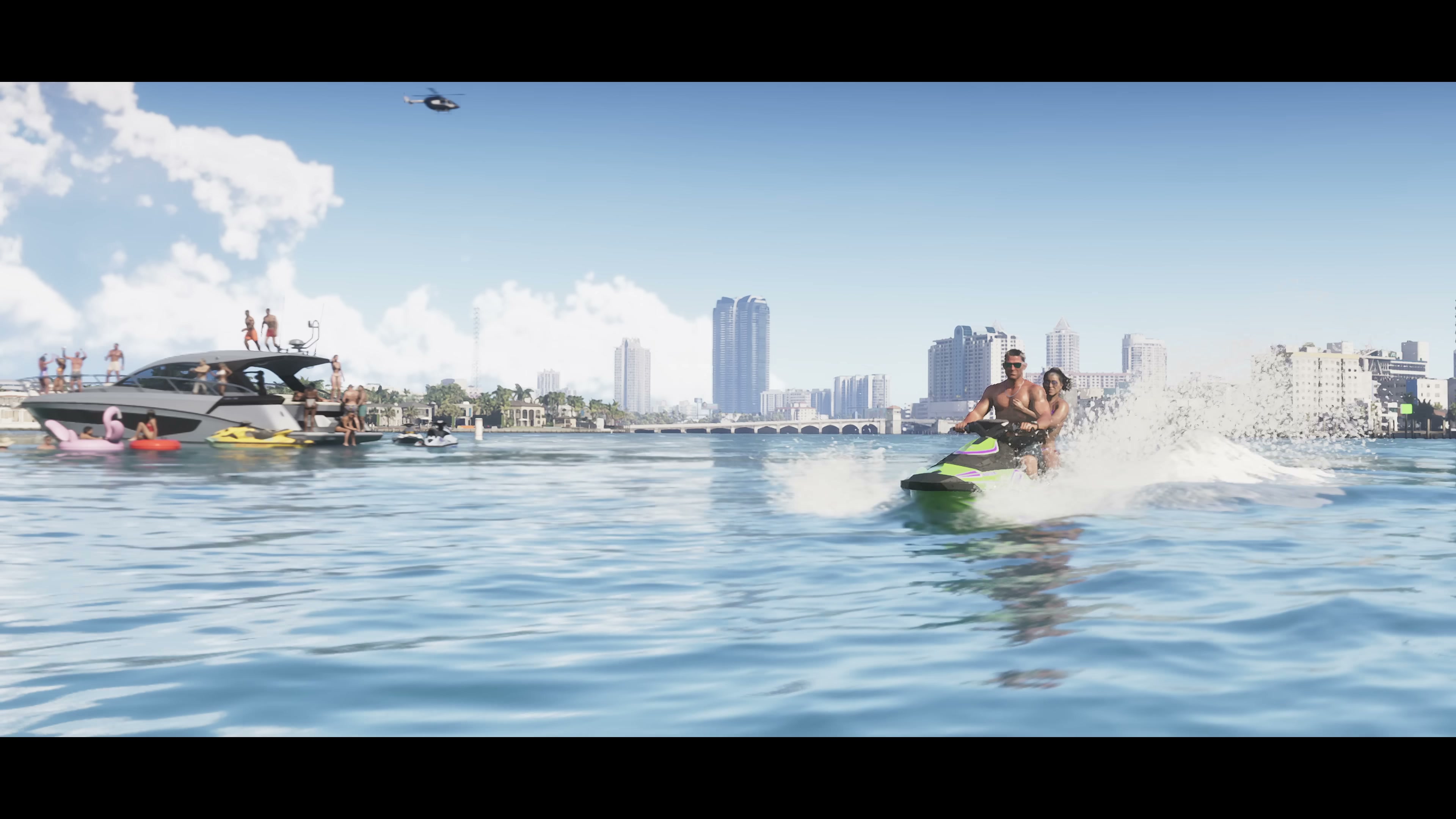
Trailer 2, 2:20 — Vice City's skyline reconfirmed from the bay side, with the Downtown / Ocean Beach axis legible behind.
Grand Theft Auto VI Trailer 2 · timestamp 2:20 · © Rockstar Games / Take-Two Interactive · Reproduced for editorial commentary under fair use. Retrieved May 21, 2026.
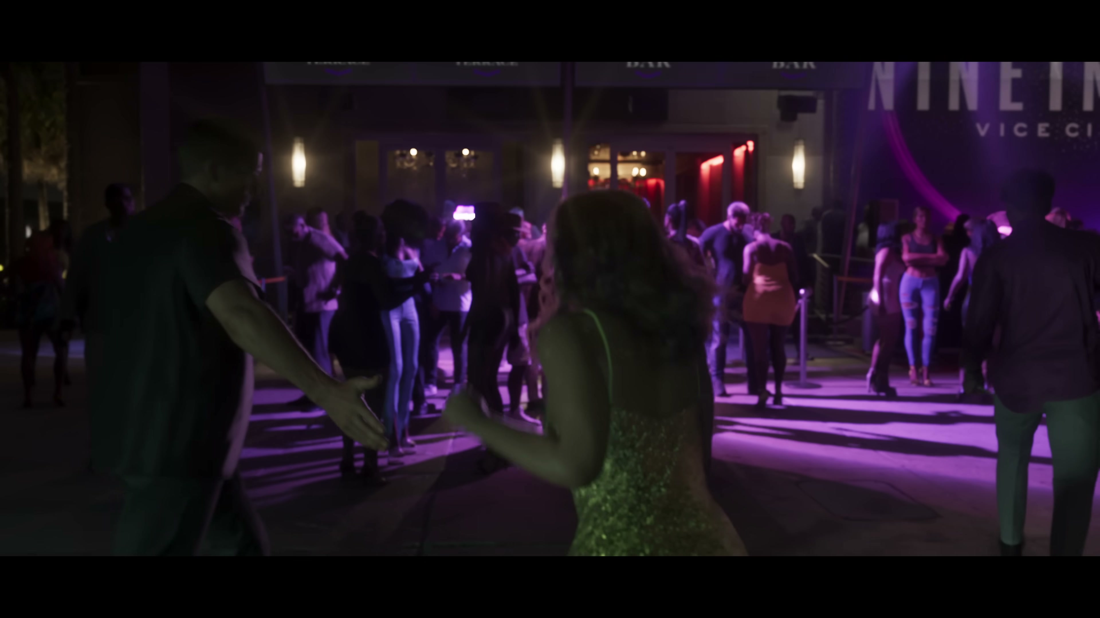
Trailer 2, 1:39 — the 'NINE' venue in Vice City, an explicit new nightlife location.
Grand Theft Auto VI Trailer 2 · timestamp 1:39 · © Rockstar Games / Take-Two Interactive · Reproduced for editorial commentary under fair use. Retrieved May 21, 2026.
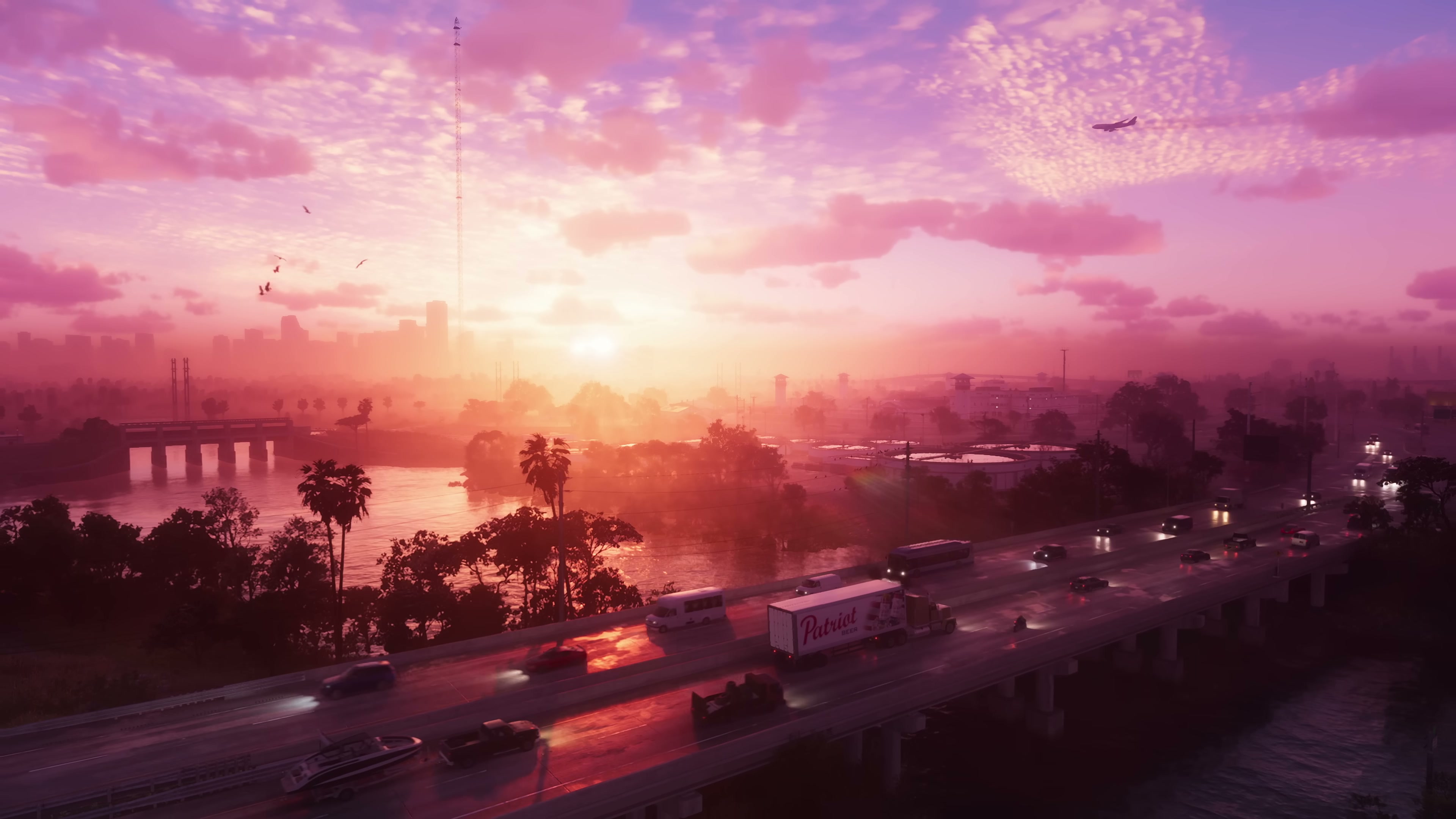
Trailer 1, 0:02 — the opening highway-over-water shot, the visual thesis of the Leonida map.
Grand Theft Auto VI Trailer 1 · timestamp 0:02 · © Rockstar Games / Take-Two Interactive · Reproduced for editorial commentary under fair use. Retrieved May 21, 2026.
YouTube sources analyzed
- IGN — 89 Details From GTA 6 Trailer 2 (7:57)
- Dandy Andy — "80% Accurate": How Fans Discovered the Entire GTA 6 Map (4:25)
- Jetro — 100+ Hidden Details in GTA 6 Trailer 2 (14:37)